

Conquering Mountains (even the little ones)
I am no mountain runner, nor do I pretend to be.
Yet I am constantly humbled by mountains, and find myself wandering through them, eager to know them, whenever I am able.
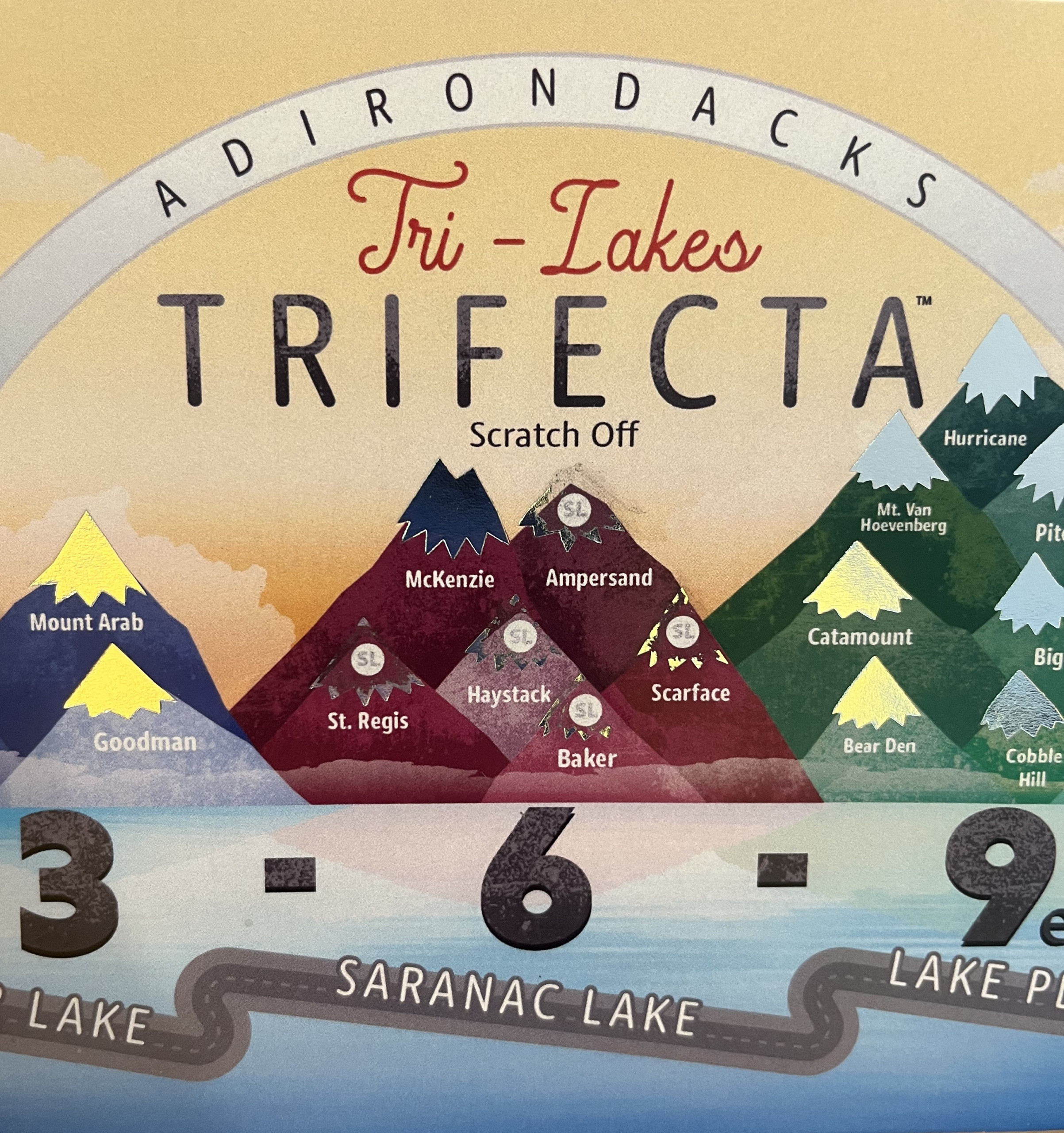
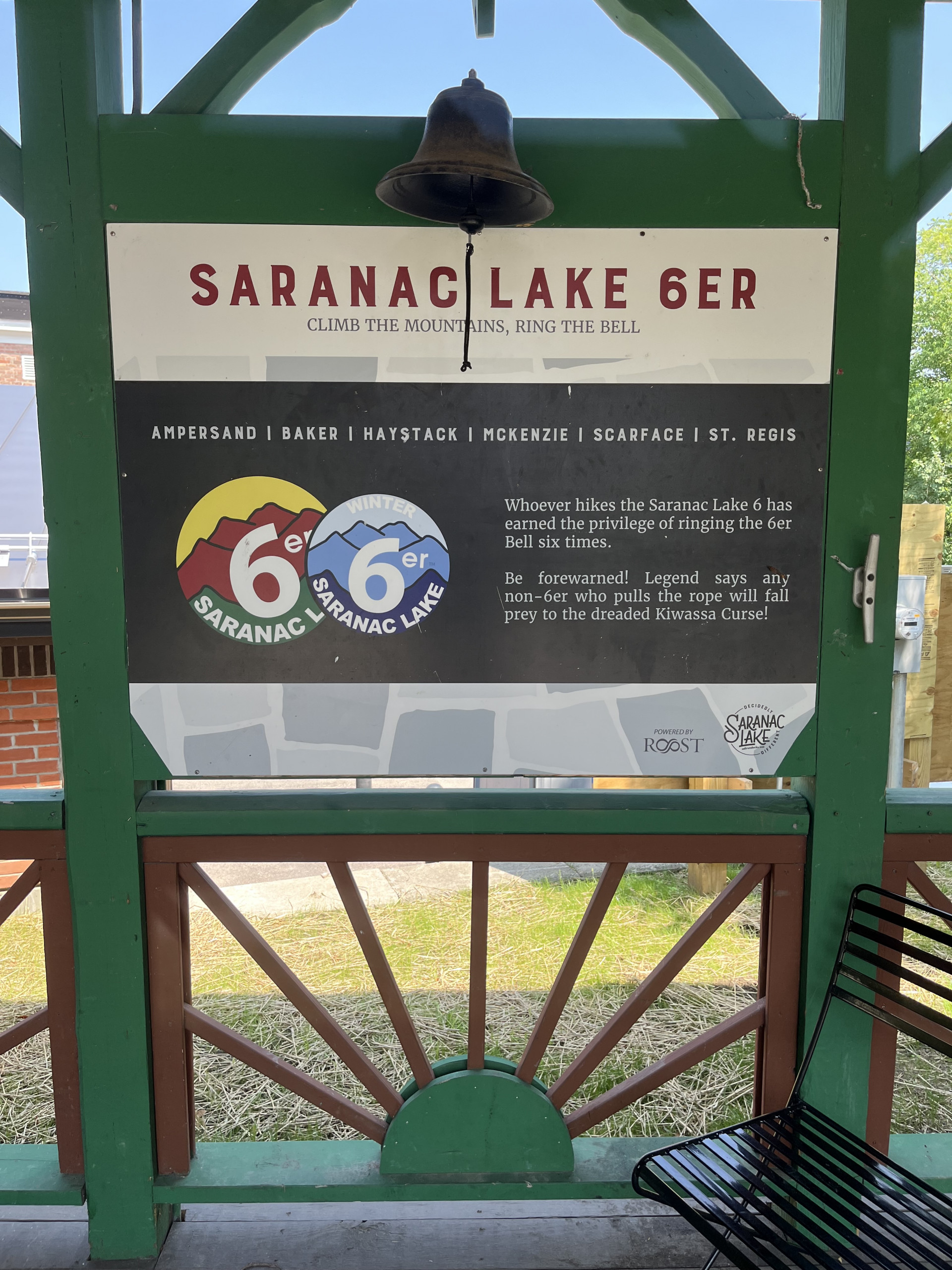
It has been a goal of mine to become a Saranac Lake 6er ever since first summiting Baker Mountain, the lowest elevation of the six, with my SIL Chenelle back in 2014. While I’ve hiked up mountains before, this was my first summit in the Adirondacks, and it planted a seed in me. But having felt some guilt because we both left our then-young daughters with our husbands for the morning, I would be content with this one climb, and shelved the idea of climbing another mountain for some time.
Baker Mountain was my 1/6 on 8/25/14.
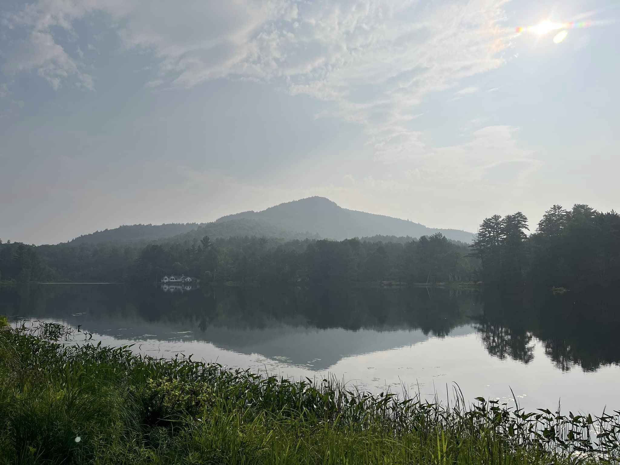
Almost two years later, I hiked Ampersand Mountain with my SILs Chenelle and Chelley, and my MIL Dawne. While Dawne swears we pulled her up that mountain, she hiked very well on her own, and I hope to be hiking mountains as she was when I reach that age. It was a relatively uneventful morning, and we were greeted by beautiful trails, as we traversed beautiful, old-growth forests of sugar maple, beech, hemlock, and yellow birch, the latter which are hundreds of years old. Just a few hours later, we arrived at the final climb to the summit, and after some hand-over-fisting, we arrived at the summit. But no views were offered to us that day. Instead, we were greeted by what felt like an immediate 30°F drop in temperature and gusting winds that made it difficult to stand up. Still, we were able to take in the summit for what it was without a view, have a few laughs, and celebrate being there, before beginning our descent. Ampersand Mountain was my 2/6 on 7/2/16.
Fast forward to 2022…
By 2022, after I had ventured into the world of trail running, I wandered into Ian’s shop for the first time and spent a few minutes talking to him about upcoming races, including Red Newt Racing’s Whiteface Mountain Race. It was then that I began to realize that I had been missing an opportunity…perhaps my mother’s death months before had sowed just a few seeds of discontent in me…you know, we only have this one life to live, and if we continue putting off too many dreams for too long, we may not get to them all… I know she didn’t realize many of her own dreams, and neither did my late father. In my case, for all the visits I had already made to the Adirondacks to see family, I had only summited two of the mountains…out of guilt at being away. But after my conversation with Ian that day, a sudden sense of unease stoked a fire that burned hot enough for me to follow through and run the Whiteface Mountain Race. And what a wild ride that was.
I may not be a mountain runner, but I can run through the mountains.
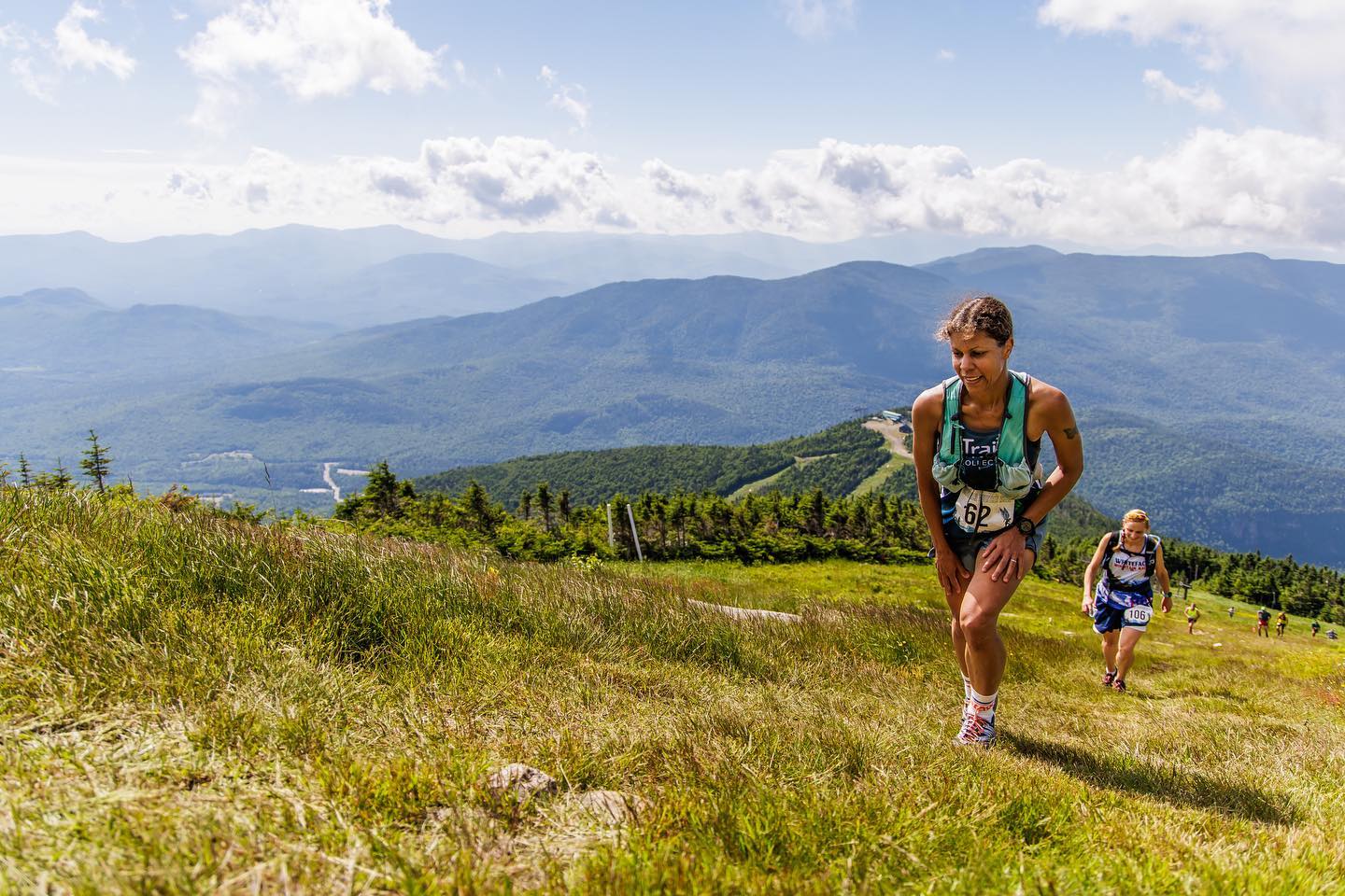
In 2023 there would be no Whiteface Mountain Race over the 4th of July weekend, but I was headed to the Adirondacks to visit family, where I would be surrounded by mountains, on legs that were stronger than they had ever been, thanks to races like the Hyner Trail Challenge, Breakneck Point Marathon, and Cayuga Trails. And all the training that went along with them. I began to consider once again my prospect of becoming a 6er. I suddenly struggled to remember why I would continue to put it off…maybe because I was now already gone so much more for some additional races I’ve done this year…but even on these family visits, the girls sleep in a bit longer, now that they are older. And the pace at the house is always easygoing. So why not just get up earlier and start getting these summits done? Summer means earlier sunrises…so why not take advantage of the additional sunlight and time that it offers?
Life is too short to always make excuses.
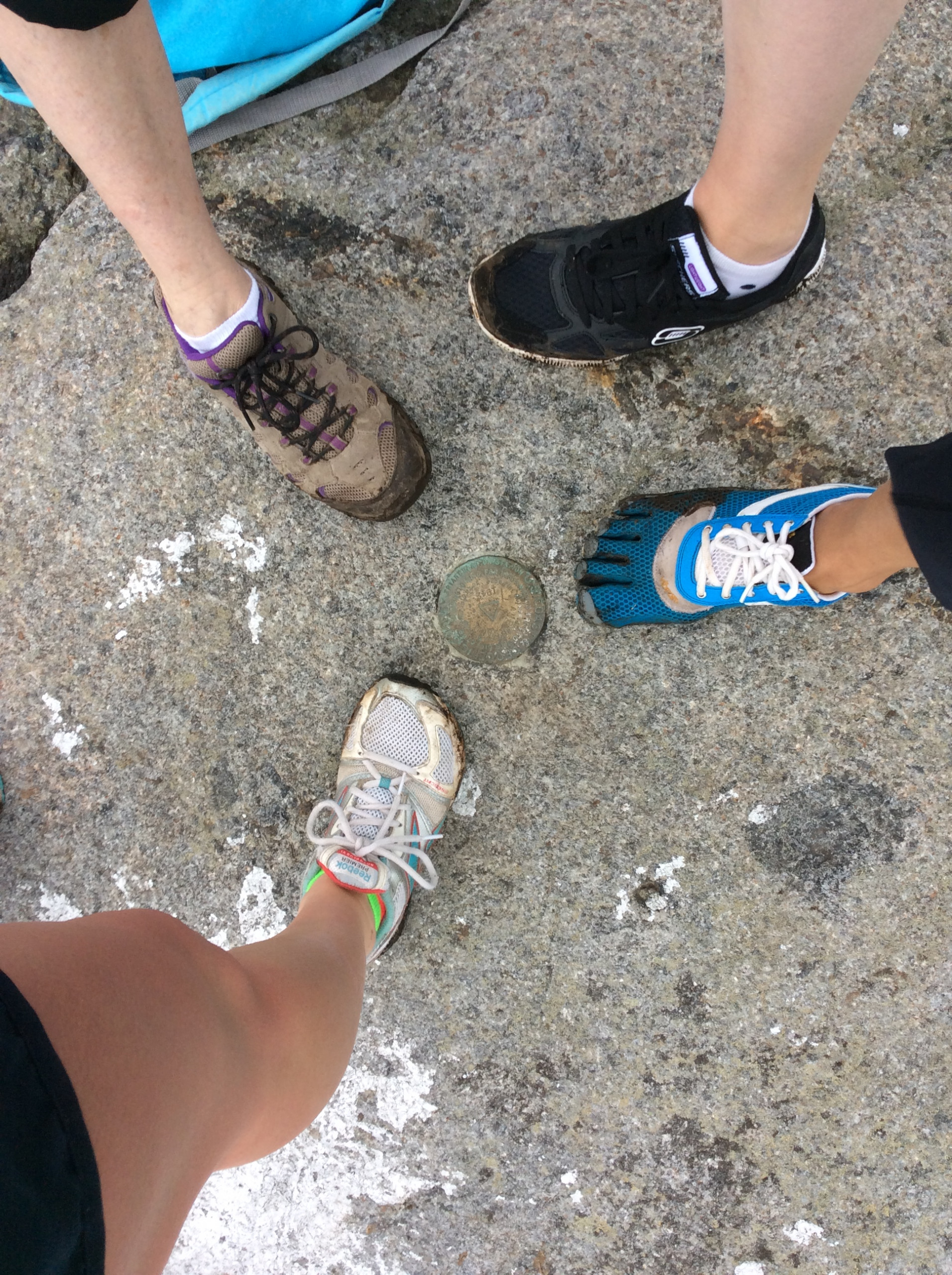
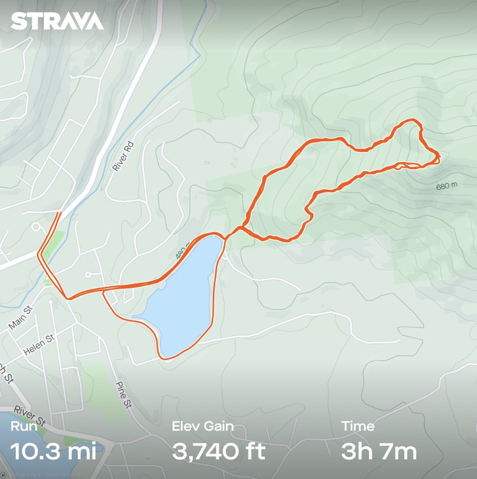
Still, feeling a bit overwhelmed at the prospect of more poor air quality and potentially having to turn back (because twice in recent weeks it’s been BAD), I chickened out of exploring Scarface, which was first on my list…instead, I left the house that first morning and summited Baker Mountain…FOUR times. First I ran up the technical right fork in the trail, which I now know best. When I came back down I decided to go up the left fork, the more runnable side, which is what Chenelle and I hiked all those years ago. Afterwards, telling myself I was done, I looped Moody Pond but then decided I was, indeed, not done. So I looped the trail around the mountain starting with the right fork, then, upon reaching the fork from the other side, I turned around and ran a loop starting with the trail on that left fork. When I reached the fork again from the right side, I finally felt satisfied (as did my quads), and so I headed for home. While the Baker Mountain trails offer a few small boulders along the way, much of the trail on the more technical side is reminiscent of the Breakneck Marathon course. Along the less technical route, trails are more reminiscent of Finger Lakes trails, with fewer rocks and hand-over-fist terrain, but plenty of roots. By the end of my run, I had seen the mountain from multiple perspectives and could call myself a Baker 6er…I had completed a “Baker’s half dozen,” as a fellow hiker in a FB group accurately dubbed it!
Clearly, I should have just run up Scarface.
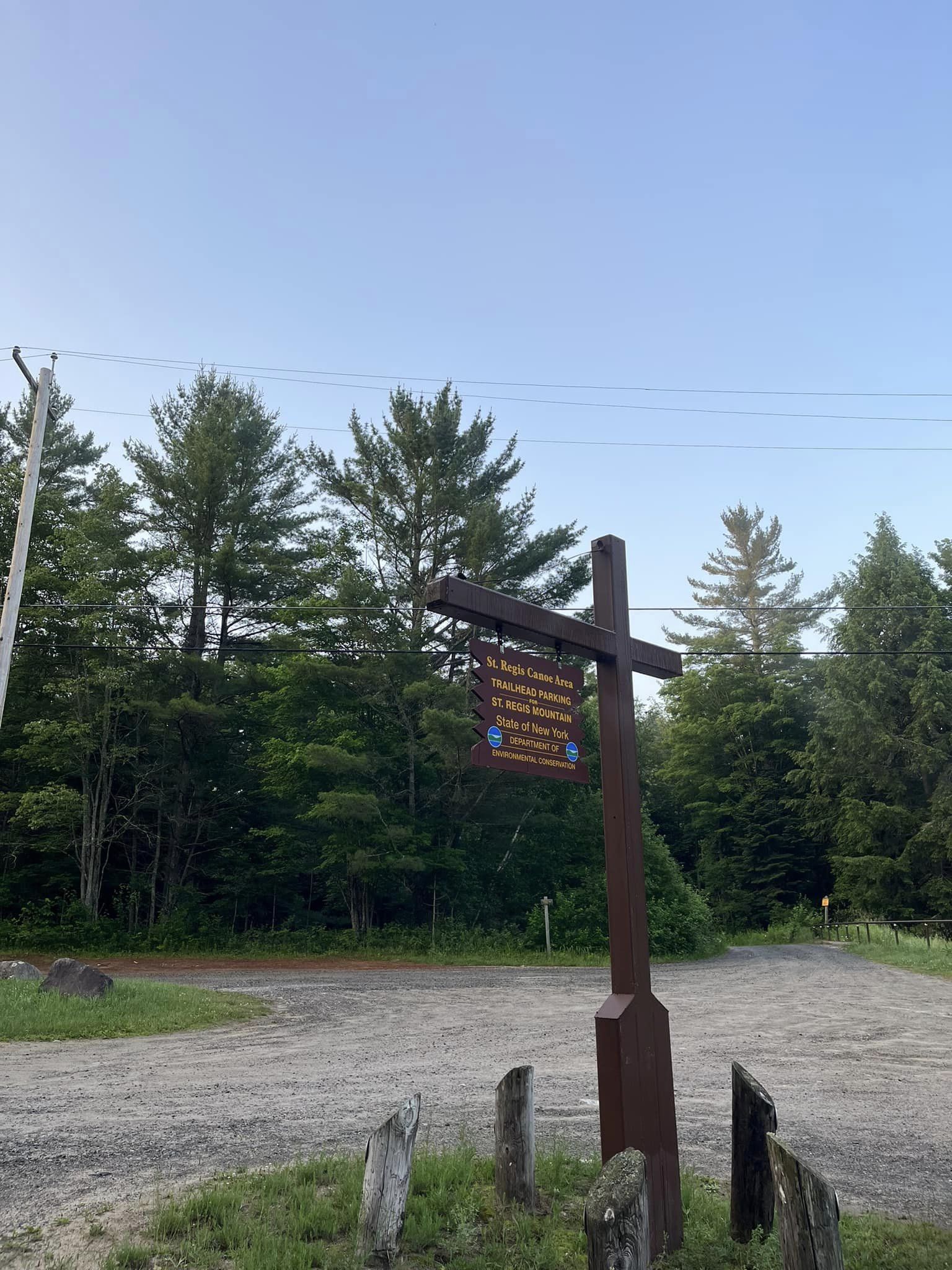
So on Sunday, when I again awoke to good air quality and a change in the forecast to no rain, I made the decision to get myself to the 6er halfway point at least, on this trip. Summiting Scarface Mountain would get me to 3/6 in my goal, which sounded amazing, having been stuck at 2/6 since 2016. Not long after I parked, another car arrived with three hikers who had made the trip from Ontario. They had summited St. Regis Mountain the day before and gave some updates on the trail conditions there, while they graciously shared their bug spray (the one thing I managed to forget). As I was then preparing to depart, one of the women said to me, “Well we’ll be out here, in case you need a rescue.” Damn. Note: if you ever encounter a solo hiker or runner at the trailhead and want to offer them any reassurance (assuming they need it in the first place), try offering it a different way. Bedside manner, folks. Needless to say, there was no rescue.
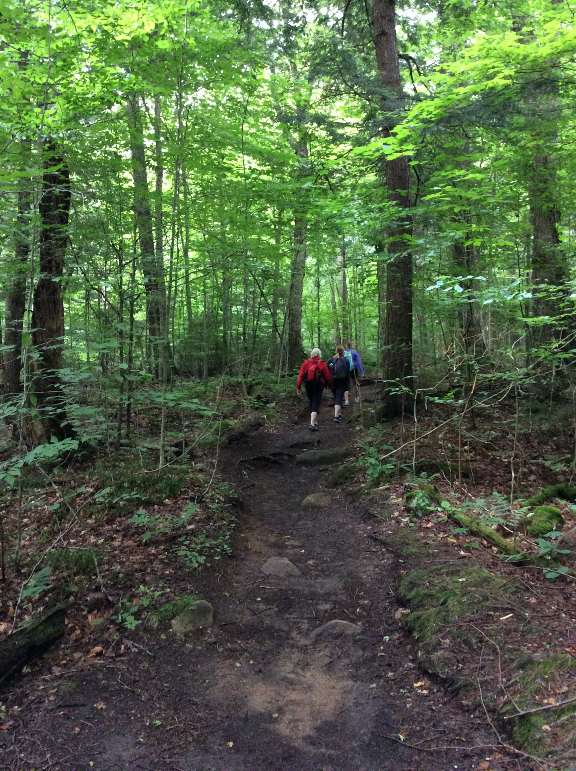
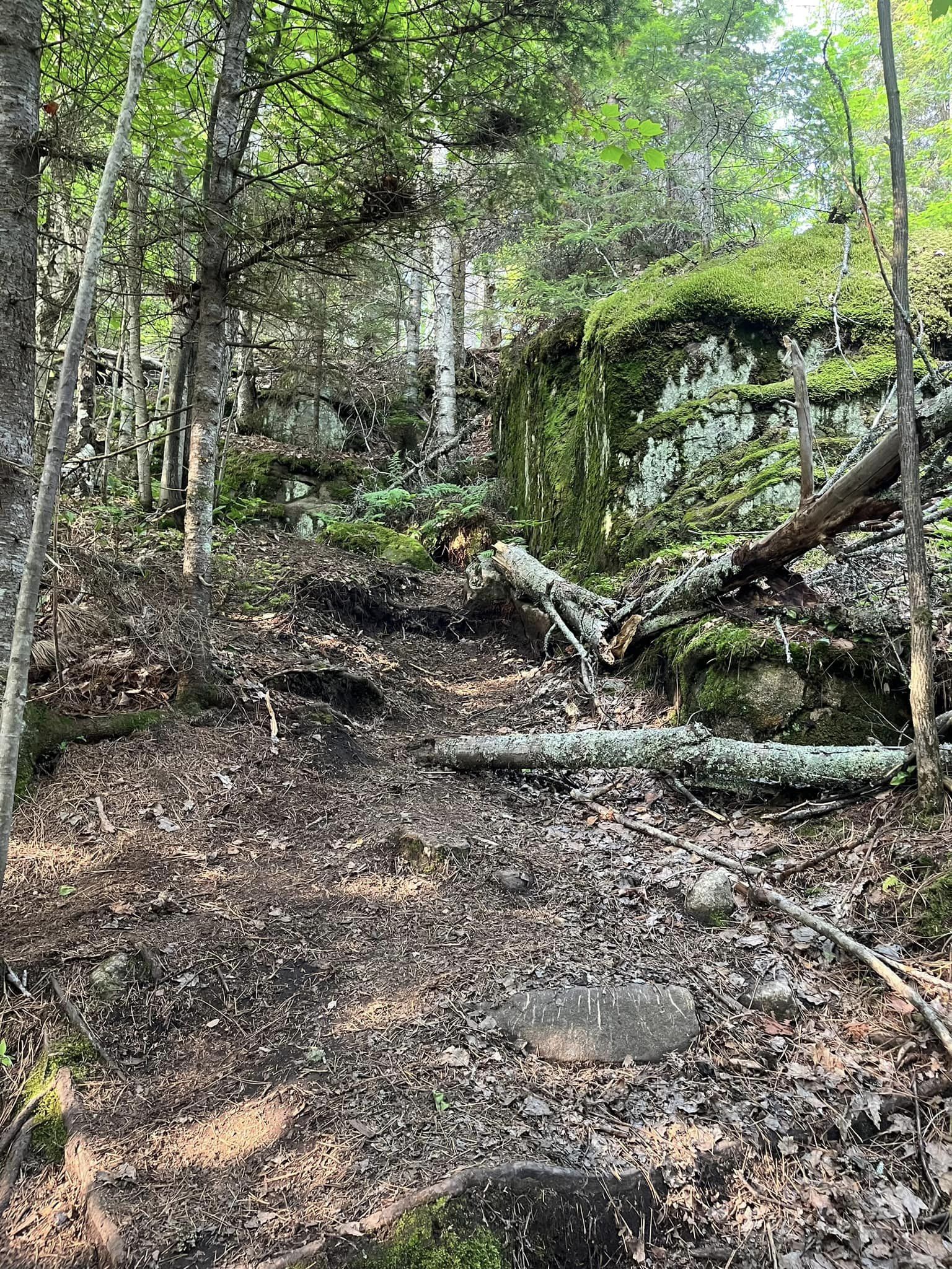
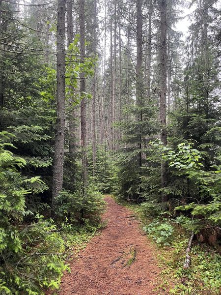
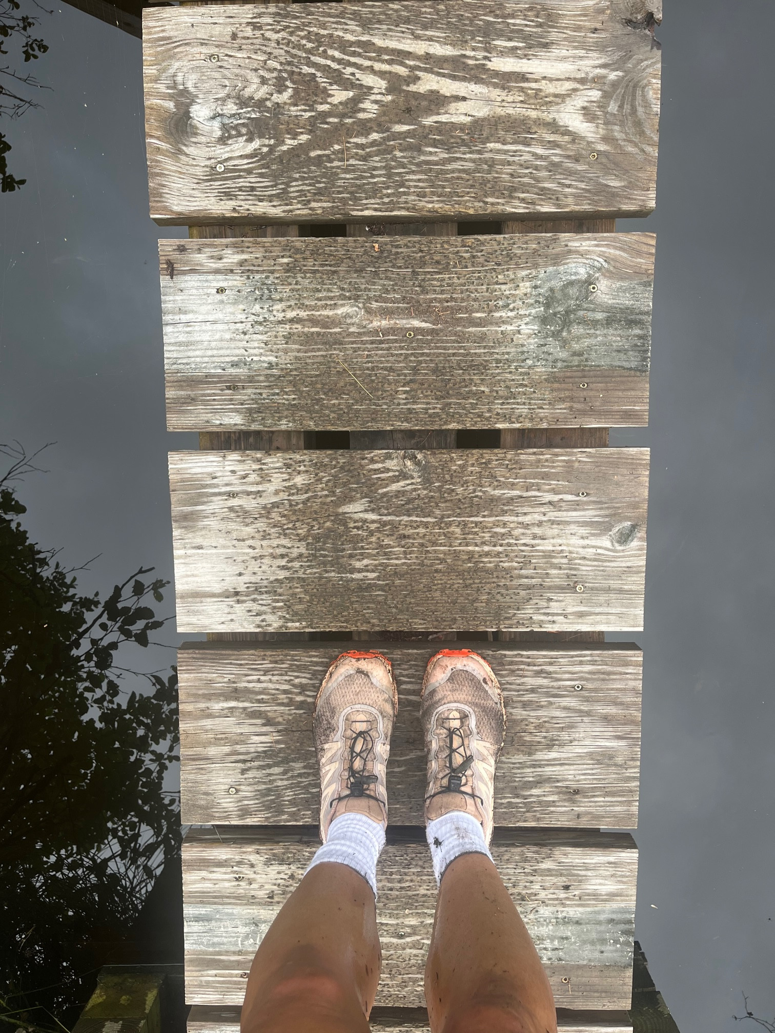
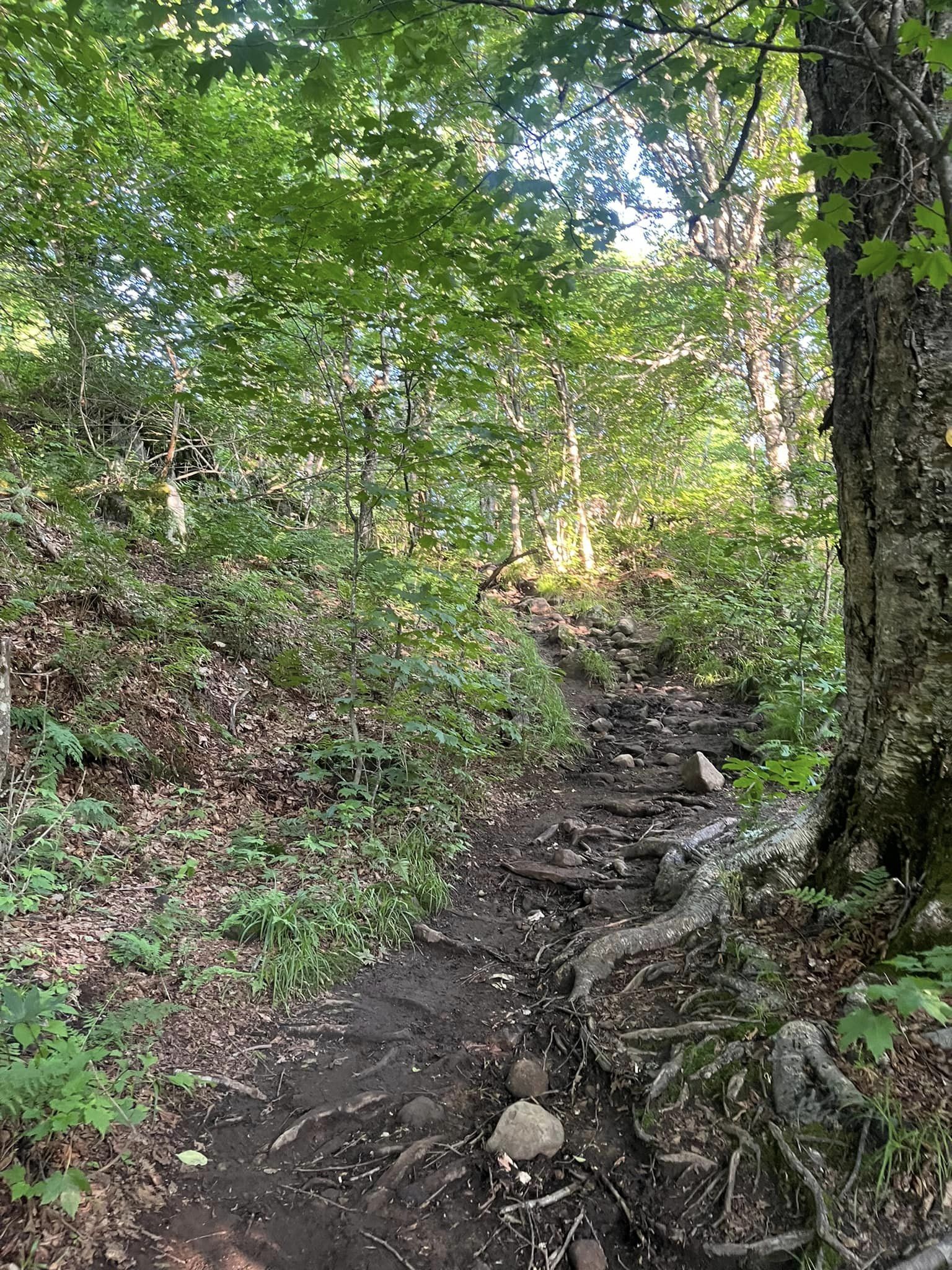
As I set off, I was immediately greeted by beautiful old growth evergreen trees, whose needles blanketed the trails and forest floor, creating a soft landing for hard-working feet. Crossing the bog, I was able to walk on the wood planks my FIL John had built for the trail some years ago. After crossing the bog I was again running under a canopy of evergreens towering above me as I traveled underneath, and I became immersed in my thoughts. I became so immersed, in fact, that I managed to miss a very obvious turn, one that included a large arrow on a tree marked “TRAIL,” as well as the logs that I jumped over to continue running, now in the wrong direction. Really, Kuwanna. After 30 minutes of circling, reaching a cow pasture (gee this can’t be right), and consulting both the AllTrails and Apple maps apps, I popped out onto the correct trail headed in the direction of the car… It was as I began to recognize landmarks that I had already passed, that I realized what had just happened. So I turned around again and, after a few minutes, came upon the very obvious turn, the one that included a large arrow on a tree marked “TRAIL,” as well as the logs that I had jumped over to continue running earlier, albeit in the wrong direction. This time I turned in the direction of the arrow, and after a few more minutes of cruising, I began to climb.
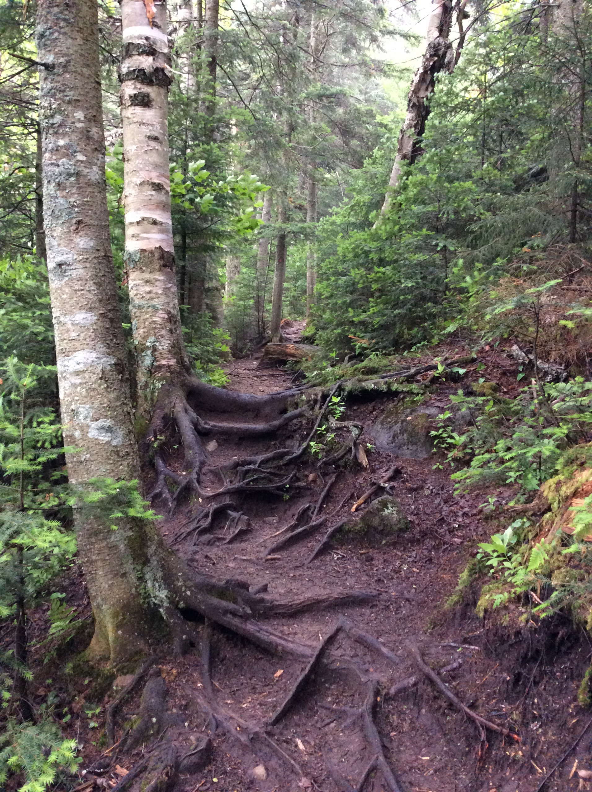
After a section that became more bouldery, with the occasional mud patch, the trail began to call for more hand-over-fist scrambling. But this eventually gave way to trails that were actually runnable again, and not far from the summit I crossed paths with the hikers I had met at the trailhead. They had been concerned when they reached the summit but hadn’t crossed paths with me…certainly they had expected me to pass them as I began my descent and they were only nearing the summit. They noticed that I had also failed to sign the registry. This was all a wakeup call for me. (Note: if you hike any of these mountains and fail to return, how will the DEC know your information and whereabouts? So I signed it on the way out and would sign registries for all the other mountains I’d climb on this visit.) But clearly my half hour of running in circles was to blame for my tardiness, and I thanked them for their concern and for watching out for me. I then headed to the summit which was still a few minutes away, and ultimately did pass them once more on the descent.
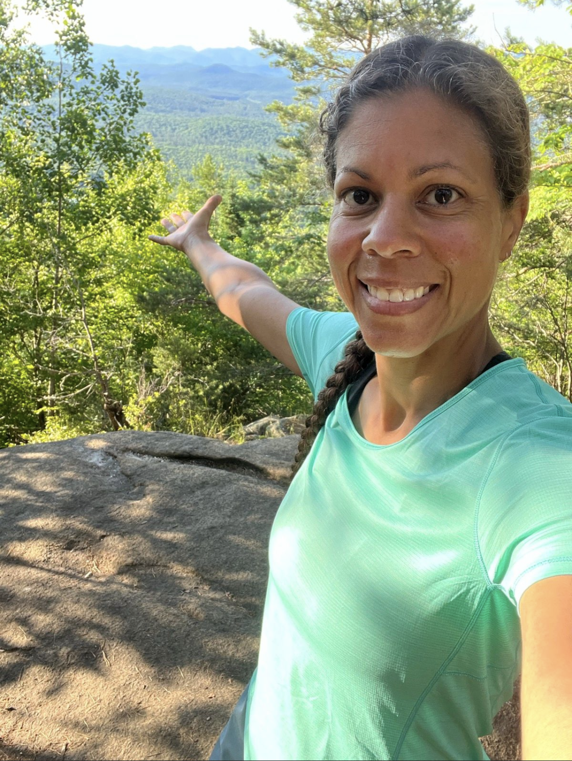
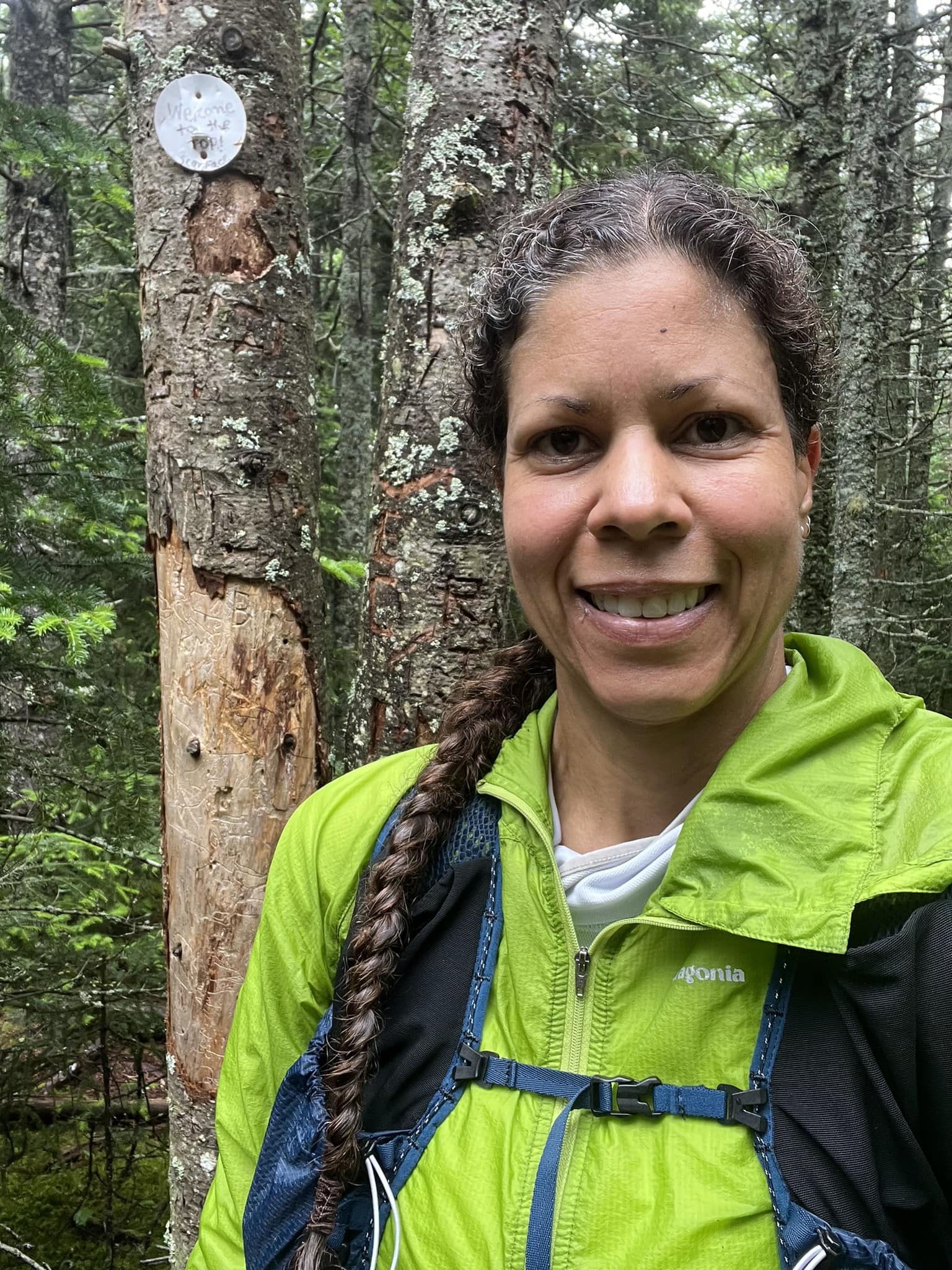
As for the summit…it’s literally in the trees. Regardless of weather, there’s nothing to see but forest and the metal tag that confirms your arrival there. Still, I knew I was now halfway to becoming a 6er, so I was fine with staring at the trees for a bit and taking in their view, before beginning my descent. After backtracking and making my way back to pine-needle-blanketed ground, I resumed running, and ran all the way back to my car. Scarface Mountain was my 3/6.
As it turns out, I would summit Scarface Mountain (7/2/23) exactly five years after I first summited Ampersand Mountain (7/2/16).
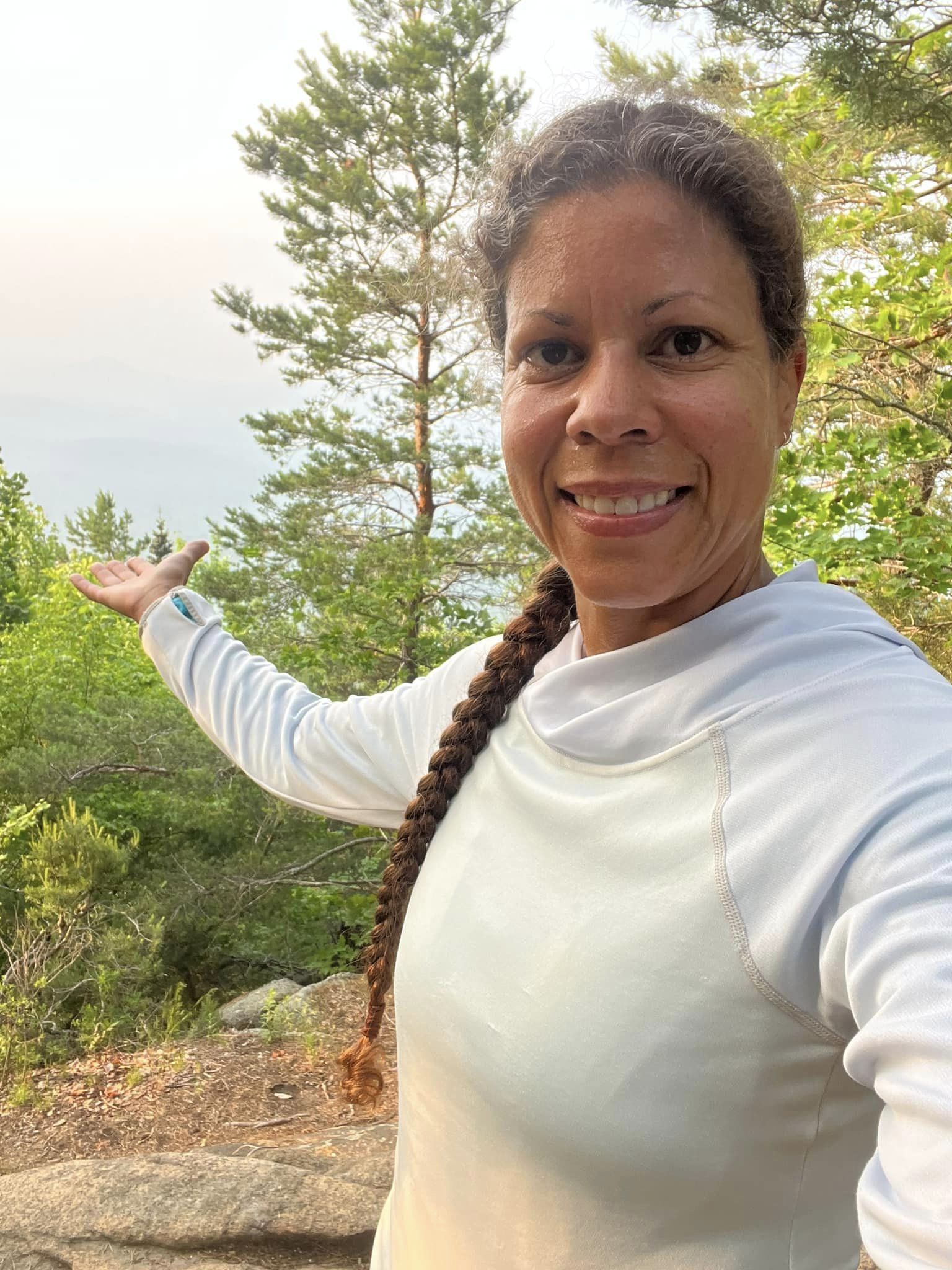
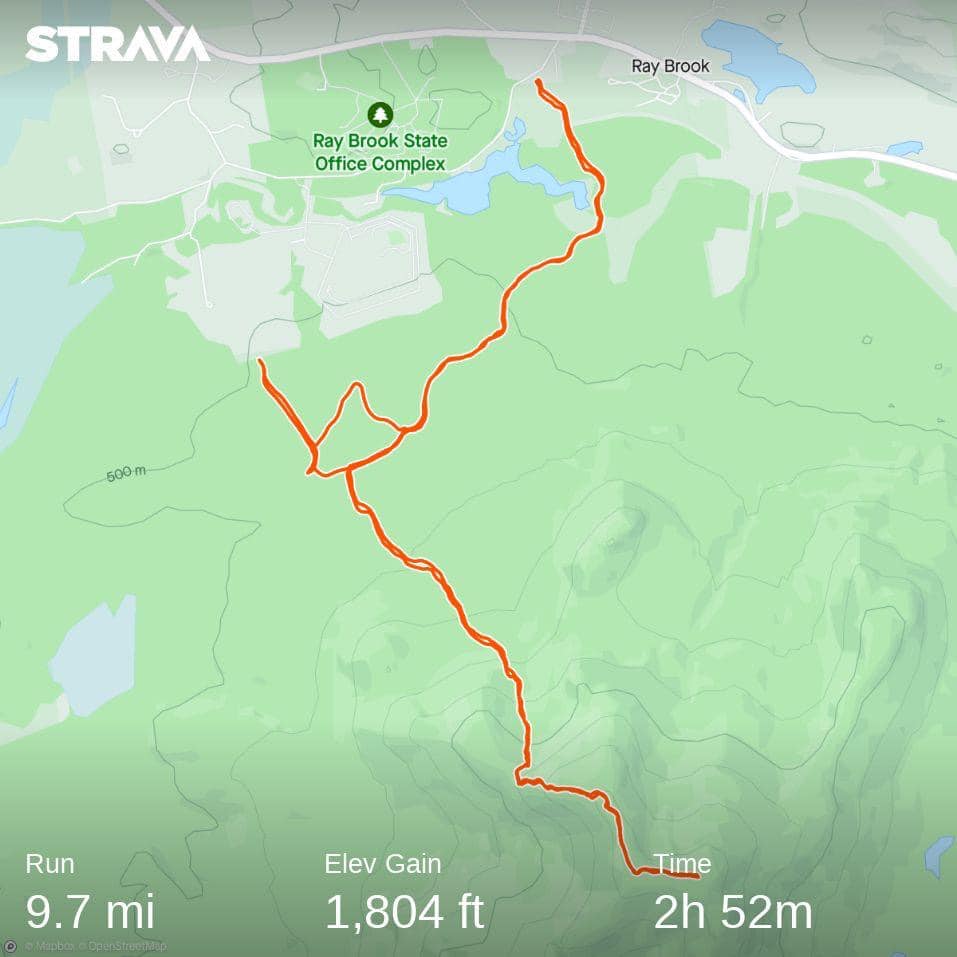
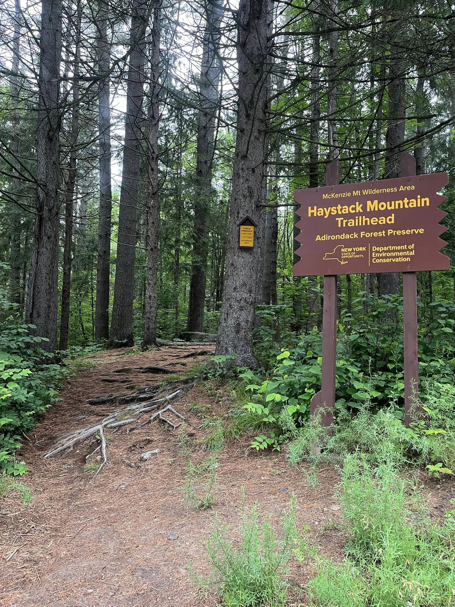
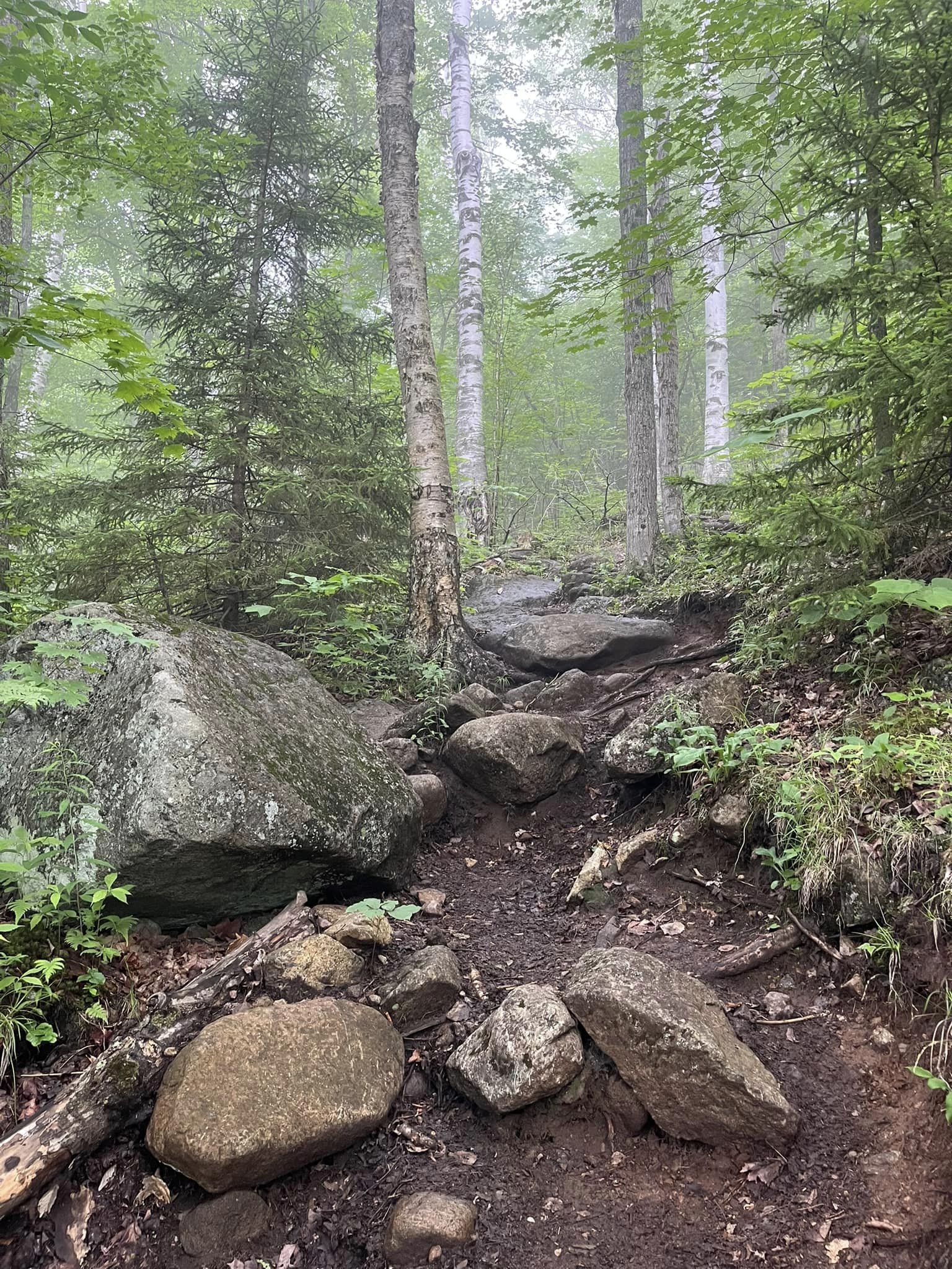
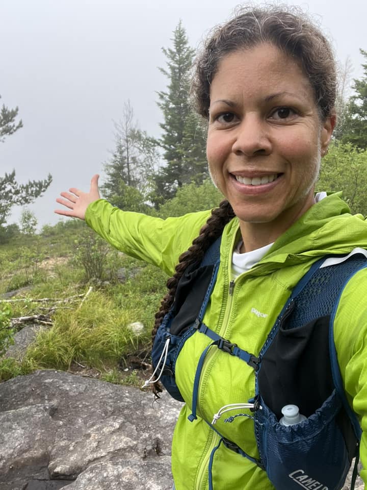
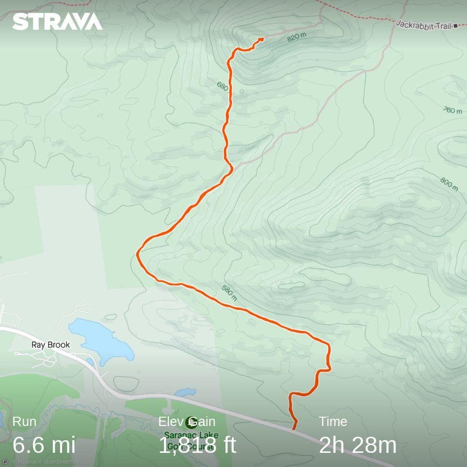
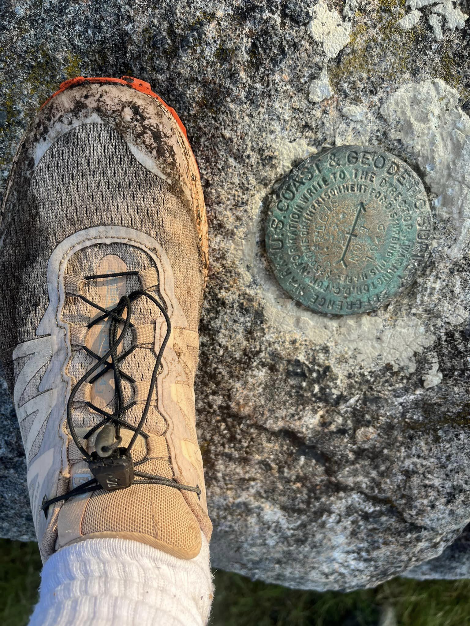
Monday felt a bit like groundhog day, as I awoke right before my alarm to find a shift in the weather patterns for the better, as well as improved air quality, leaping out of bed, getting dressed, and heading out the door. On today’s agenda: Haystack Mountain. When I arrived at the trailhead, there were two cars parked here, and I’d encounter this party of four near the summit and on my way back down the mountain. When I arrived, I was absolutely elated to be there; I’d lost track of how many times I’ve driven past this trailhead on 86, only to be headed somewhere else, but dreaming of the day when I’d finally see these trails and summit the peak. I signed the registry, and while I did run a mile or two along the flatter first miles, there was some rock hopping and log walking to avoid muddier mud patches. As I climbed in elevation, I really began to recognize and feel the magnitude of this mountain, compared to Baker and Scarface. The last mile or so definitely evolved into a slow hike, with hand-over-fist climbing and a few extra breaks, as I approached the summit. As I paused, I’d take in the scenery and compare it to the trails I frequent on a daily basis, and this place seemed otherworldly to me. I felt the magnitude of just how far and high our legs and lungs, when strong, can take us. As I approached the summit area, I encountered the four hikers whose cars I had seen in the parking lot, and we exchanged pleasantries as they assured me I was close. After a brief conversation and some more huffing and puffing, I made it to the summit. And again there were no views, as the mountain was surrounded by clouds that morning. But how amazing it was to be there anyway. I paused my watch to wander around, looking for the GPS marker. After not having any success, I took a few photos, then began my descent. While the downhill occurred much faster than the uphill, the first part of the descent was a bit sketchy for me. I took my time and was confident in my footing before committing to a step forward (or down), but I still managed to slide just a bit, crashing my left kneecap into a boulder. Thankfully, other than some bruising, the knee would ultimately be fine.
Before reaching the flatter regions, I encountered the four hikers again, and the five of us hiked together for a short time, exchanging stories and backgrounds. It turns out one couple was also in town visiting in-laws, who live near Ampersand Mountain. And they frequent Ampersand as much as I do Baker when in town. Ultimately, I bid them farewell and resumed running down the mountain. This was 7/3/23 and Haystack Mountain was my 4/6.
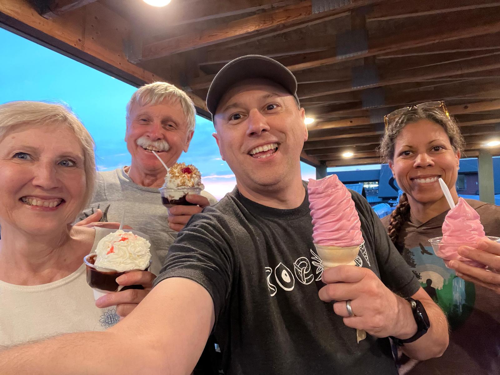
Tuesday was the 4th of July…after an epic month of racing, followed by several mountain summits over just as many days, on this day I rested: I ate barbeque and ice cream, watched fireworks with my family, and drank beer.
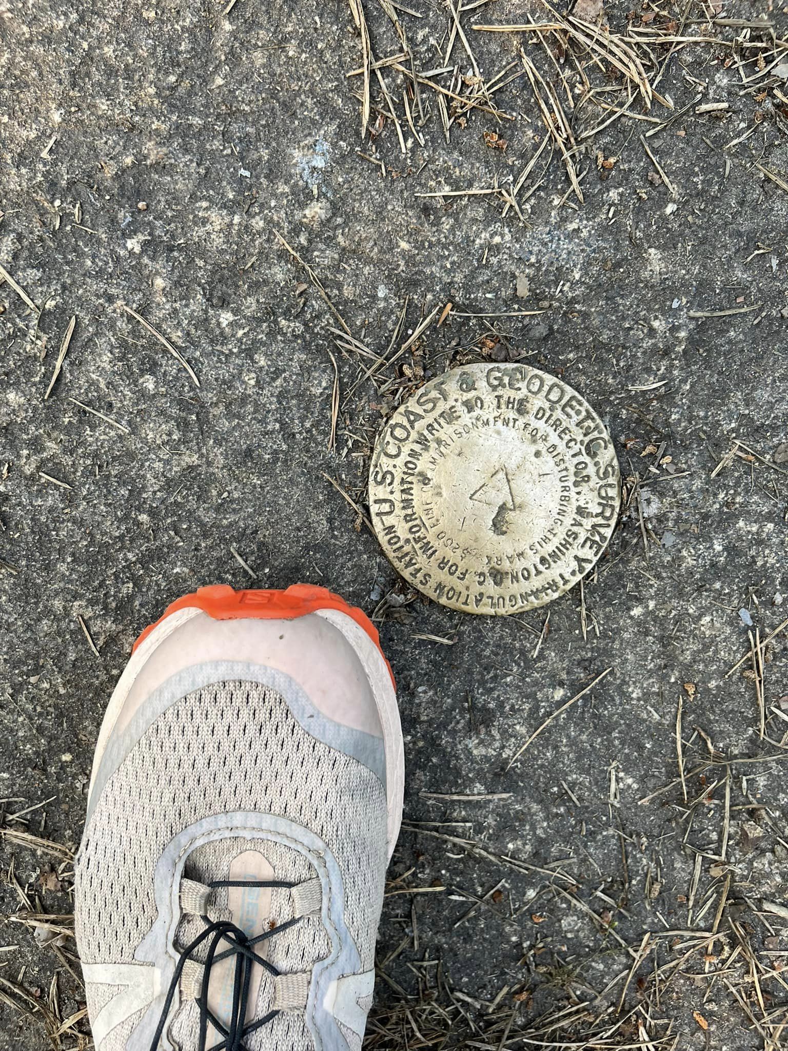
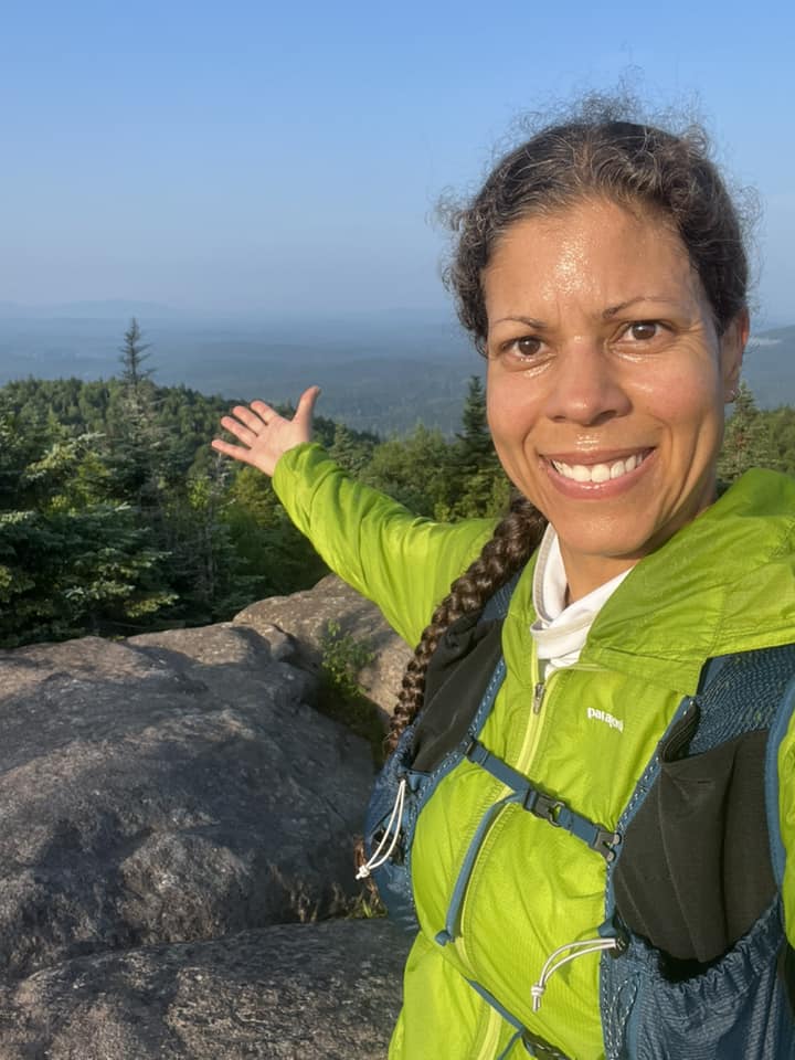
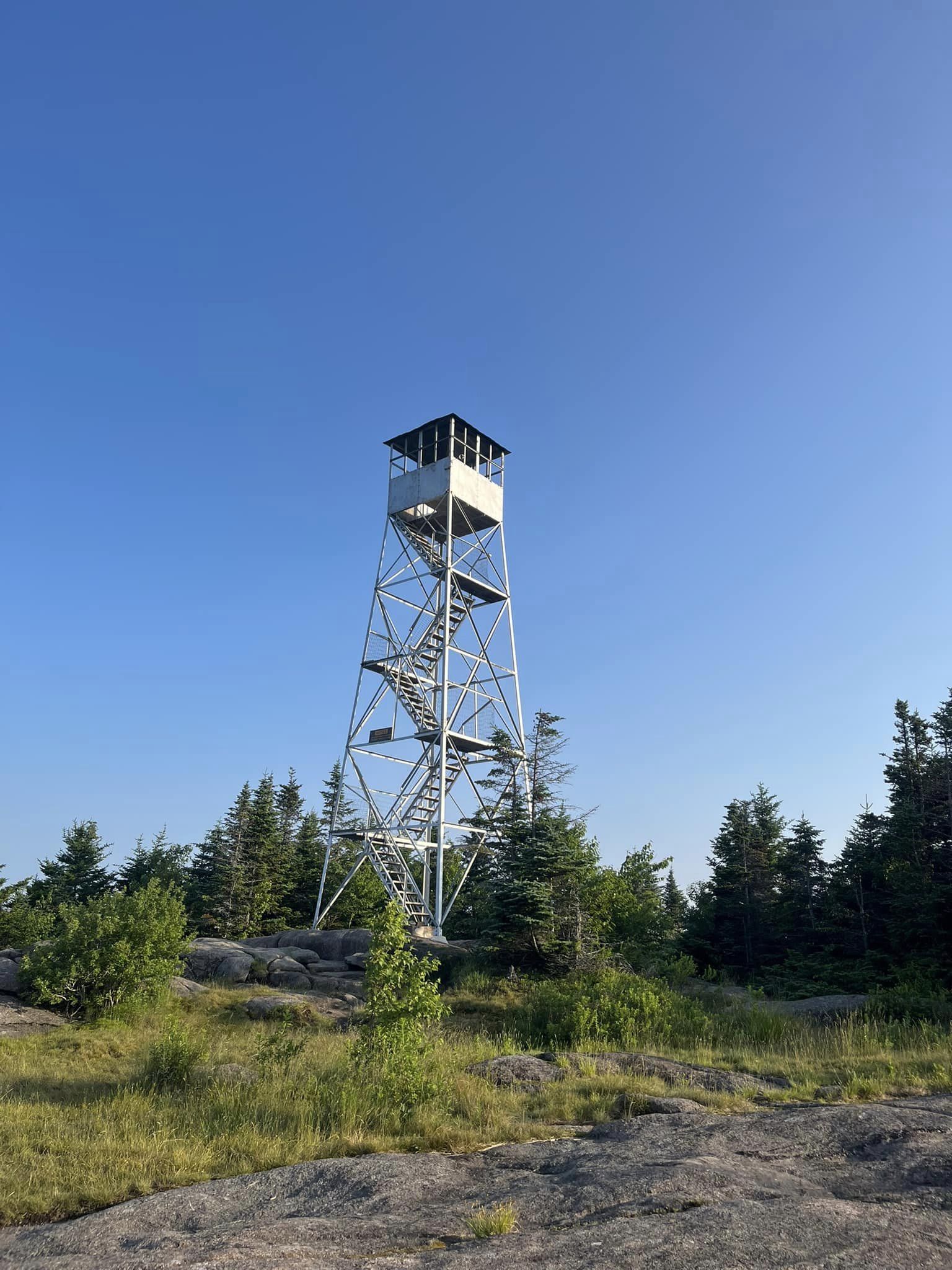
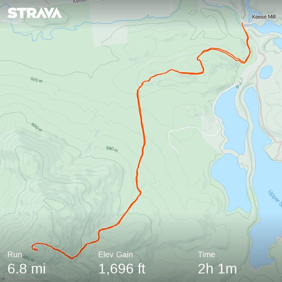
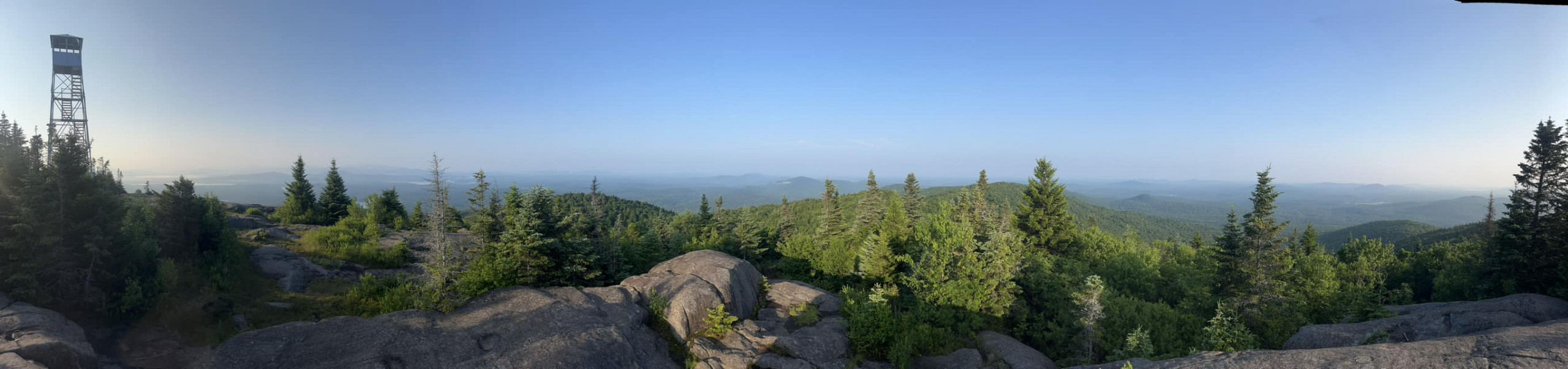
Wednesday was the day we were headed out of town… But St. Regis Mountain had started calling to me the day before, somewhere in between the Glutenberg and the White Claw I enjoyed for the festivities. I wondered…could I get this last summit done and leave with my goal at 5/6? So this day called for a 5:00 am wakeup, though naturally I awoke before my alarm sounded. The skies were now clear and the air quality was wonderful. So I got dressed, fed myself, and proceeded to drive the roughly 20 minutes to the trailhead. Wasting no time (because the deer flies there were also abundant), I was able to begin my run up the mountain at 5:55 am (I paused to sign the registry). St. Regis was easier for me than Haystack, though somewhat muddier, and the later sections of trail approaching the summit involved maneuvering boulders, though many of these could be hiked over and around. But I was in such a rush in my mind, I forgot to notice the trees. Soon after I reached the summit, and though I was originally in a rush, I decided to take a few minutes to wander the summit area. And there were views! I was able to find the GPS marker, take a few photos of the surrounding landscape, and even climb up the fire tower. When I finally felt as though I had immersed myself in the experience as much as I could, I felt it was time to begin my descent. We were trying to leave town for Massachusetts, afterall.
I would not encounter anyone until a few minutes after I began my descent, in this case a solo hiker with her unleashed dog. Though I tried to be cautious, I managed to startle the dog, who then barked at me in a disconcerting manner and would not allow me to pass, in spite of the frequent requests from its owner. Ultimately, I stopped moving forward and asked her to leash the dog. She seemed very confused at the dog’s behavior but very accommodating to me. Dog owners often appear confused when their dogs begin to bark, but the reality is that I am unfamiliar – I am a stranger to them. Though somewhat unsettling, I refused to let this encounter color my experience on St. Regis Mountain. After passing back through the bouldery section, I began to run…I knew I was now at 5/6 in my goal of becoming a SL 6er, and the remaining miles clicked by as I felt nothing but euphoria and pure abandon. St. Regis Mountain was my 5/6 on 7/5/23.
Just one more left.
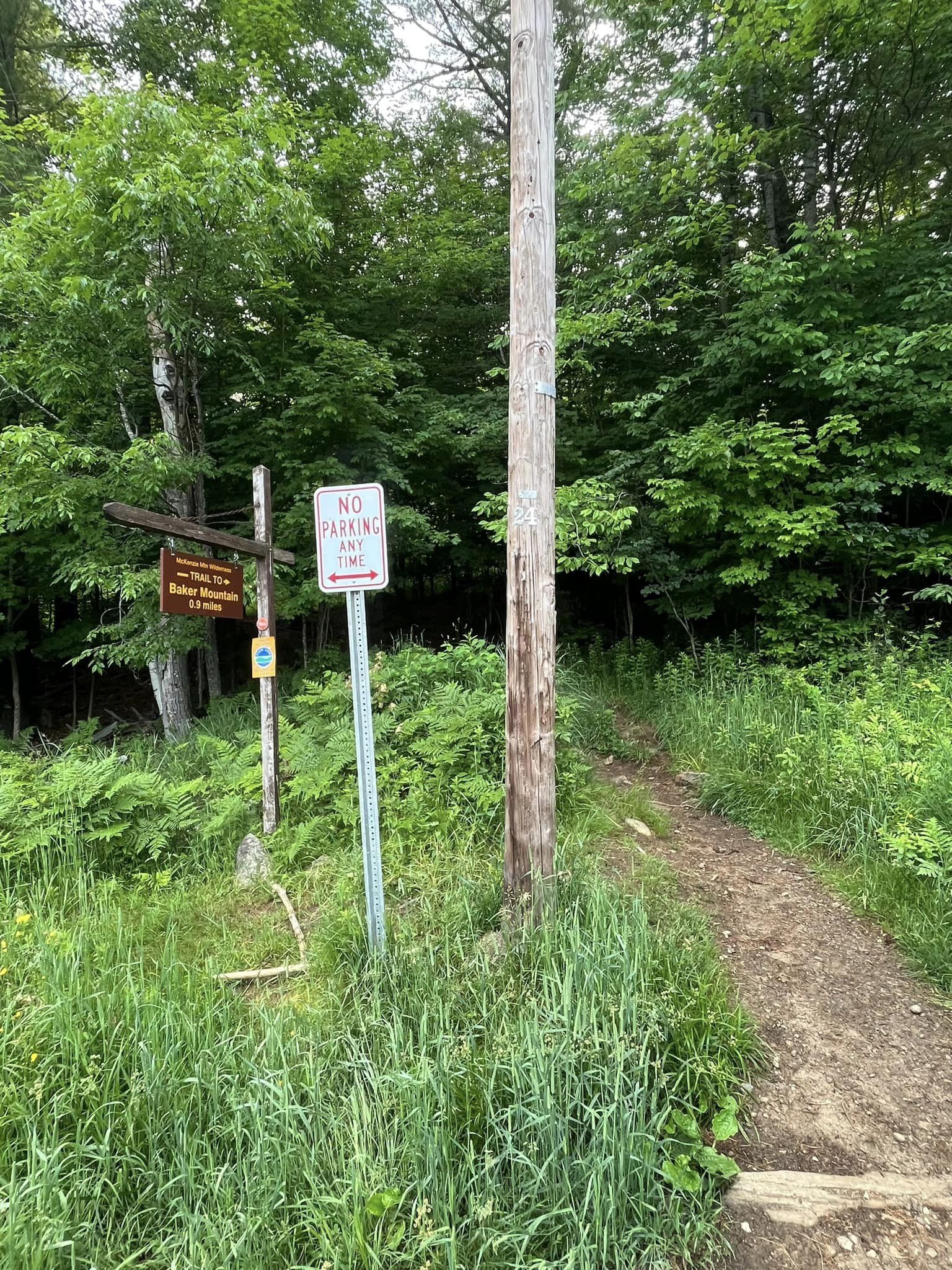
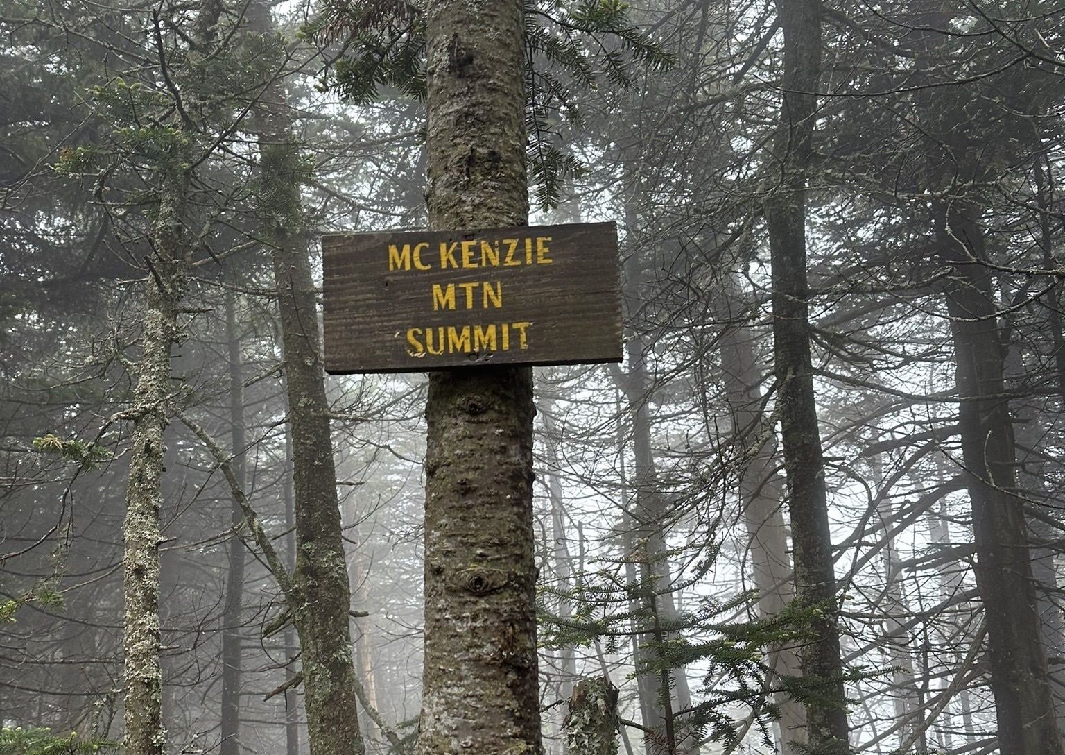
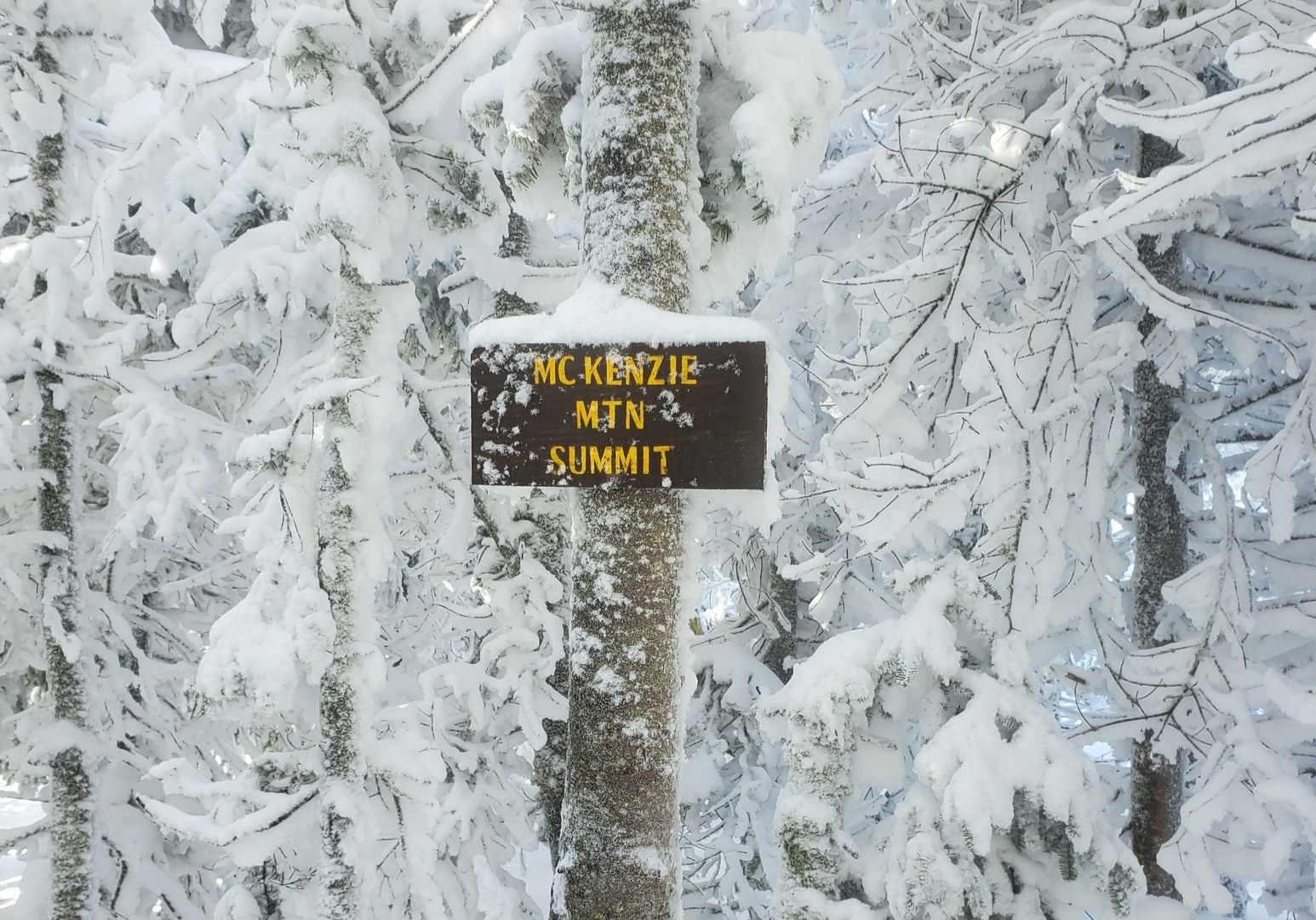
I’ve decided to save McKenzie Mountain for my last summit on my way to becoming a Saranac Lake 6er (of course, had I gotten my act together sooner this last round, I would have already done it.) When I head there, I’ll likely access the mountain via the Jackrabbit Trail from Lake Placid, as this route is shorter than accessing it from the Haystack Mountain Trail off of Route 86 (unless you are summiting both mountains, of course). We’ll see if I have the patience to wait until my next summer visit, or if I’ll recruit someone to help me with a winter summit, should I return again at the end of this year. While I’ve successfully summited Baker Mountain solo during the winter a few times in microspikes, I have a healthy respect for the greater time I’ll spend in the McKenzie backcountry, on trails that may not everywhere be apparent due to the covering of snow, as well as an increase in approach distance, greater elevation, and potential for ice-covered scrambles. Depending on how much snow and ice are present, snowshoes and crampons (in lieu of microspikes) may very well be in order.
In the meantime, I’ll bask for just a moment in this recent accomplishment, as I remember the days when I was once afraid to circle even the trails around the pond at home alone.
And I’ll continue dreaming just a little bit longer of the day I get to ring the bell six times in downtown Saranac Lake.
Related Posts
Add Comment
You must be logged in to post a comment.